
Share
Published 09:27 11 Nov 2015 GMT
 Add us as a preferred source on Google »
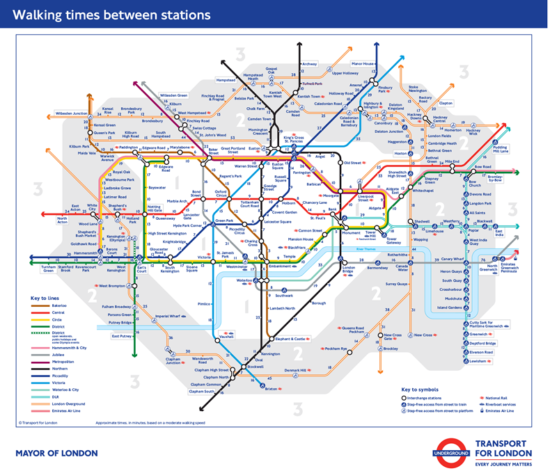 "What we have seen is that people are desperate for this sort of thing, so we have created it," a TFL spokesperson told the Evening Standard.
"We focused on central London, zones 1 and 2, and based the times of our journey planner.
The stroll from Leicester Square to Covent Garden takes just four minutes - hardly worth tackling the Underground crowds for. Meanwhile Charing Cross to Embankment takes just three minutes on foot, plus you burn a few calories and soak up plenty of atmosphere en route.
"What we have seen is that people are desperate for this sort of thing, so we have created it," a TFL spokesperson told the Evening Standard.
"We focused on central London, zones 1 and 2, and based the times of our journey planner.
The stroll from Leicester Square to Covent Garden takes just four minutes - hardly worth tackling the Underground crowds for. Meanwhile Charing Cross to Embankment takes just three minutes on foot, plus you burn a few calories and soak up plenty of atmosphere en route.
Explore more on these topics: